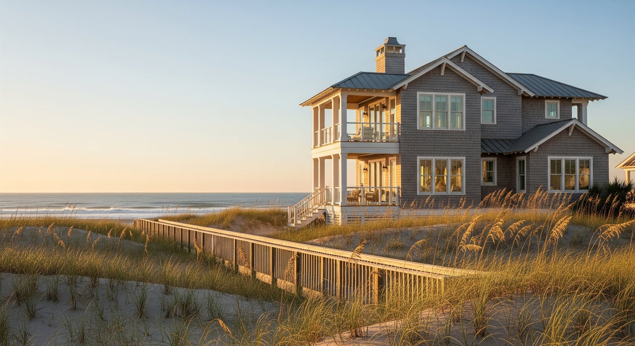
Will your boat float off the dock at low tide or sit in the mud? If you are shopping waterfront in Wilmington, the phrase deep-water access comes up early and often. You want confidence that your dock can serve your actual vessel, not just a listing description. In this guide, you will learn how to evaluate depth, tides, routes, and permits so you can buy with clarity. Let’s dive in.
What deep-water means
Deep water is not a fixed number. It means you can reach a navigable channel or the ocean without frequent grounding during normal tides. What counts as deep depends on your boat’s draft and the air clearance you need along your route.
For most buyers, deep-water access comes down to three things: consistently usable depth at or near the dock during normal tide cycles, reasonable proximity to a maintained channel, and enough vertical clearance under bridges or lines. Your verification should address all three.
Draft, depth, and clearance
Understanding a few core terms will make your search faster and safer:
- Draft: the depth your hull needs to float. Compare your boat’s draft to the measured depth at the dock at low tide.
- Air draft: the height of your vessel above the water. Check bridge and line clearance along your route.
- MLLW: chart depths on NOAA charts use Mean Lower Low Water. You can add the predicted tide to estimate actual water depth at a given time.
- MHW and MHHW: benchmarks used for shoreline placement and permitting. Useful when planning docks and bulkheads.
- Federally maintained channels vs private channels: federal channels are dredged on a published schedule. Tidal creeks and private canals can shoal and change.
Helpful draft ranges to keep in mind:
- Small skiffs and center consoles: about 1 to 2 feet
- Typical power cruisers and runabouts: about 2 to 4 feet
- Many monohull sailboats: about 4 to 6 feet
- Larger trawlers and yachts: 5 to 8+ feet
The takeaway: define your vessel first, then judge whether a property is truly deep water for you.
Wilmington waterways snapshot
Cape Fear River
Wilmington Harbor on the Cape Fear River is a commercial waterway with federal channel maintenance. It offers reliable depth for larger vessels, though you will share space with harbor traffic and need to navigate the marked channel.
ICW and local sounds
The Atlantic Intracoastal Waterway near Wrightsville Beach and Masonboro Sound serves many waterfront homes. Depth is generally maintained, but segments can shoal. Banks Channel and nearby tidal creeks can be shallow in places and vary with storms and seasons.
Inlets and shoaling
Masonboro Inlet and Carolina Beach Inlet are dynamic. Sand moves quickly, especially after storms, which can change depths for months. Living closer to an inlet can shorten your ocean run but increases exposure to currents and shifting bars.
On-showing dock checklist
Use this quick list to evaluate a property in person:
- Measured depth at low tide: ask for recent readings relative to MLLW. Confirm the method used, such as a calibrated sounder.
- Bottom type: sand, mud, or marsh affects anchoring, piling, and future dredging.
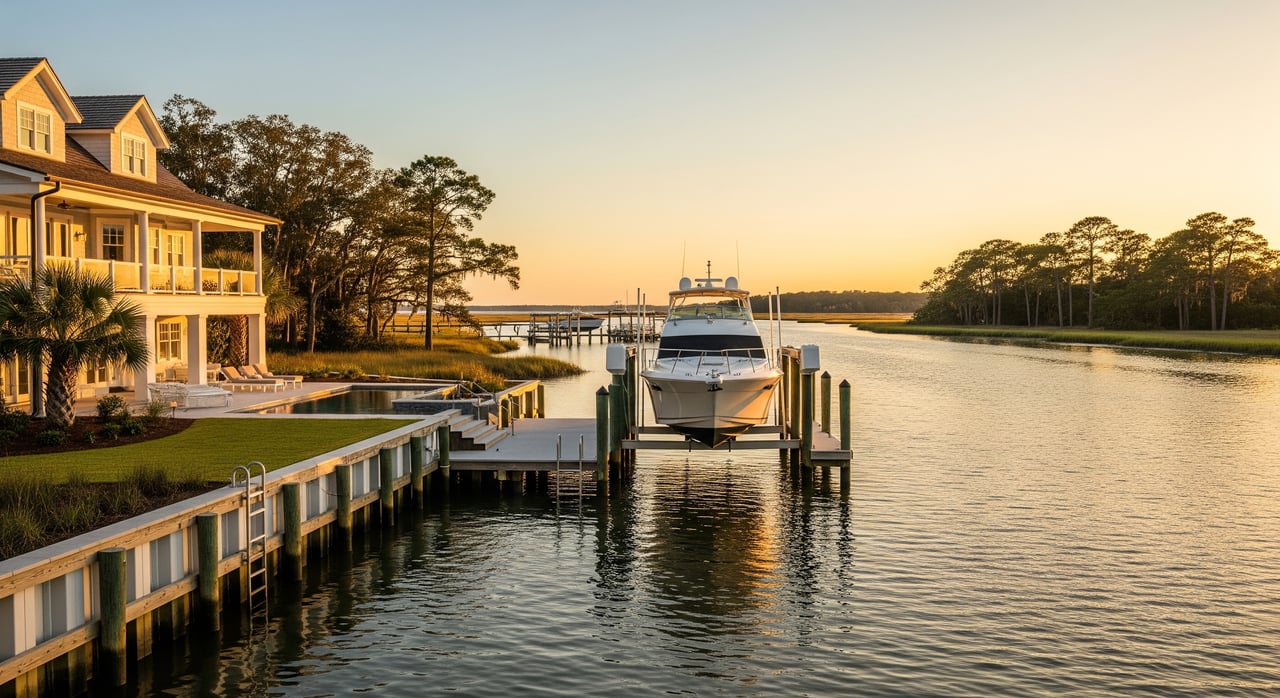
- Dock structure: pile size and spacing, decking condition, fasteners, cleats, and any boat lifts or davits. Check power and water at the dock.
- Bulkhead or seawall: look for scour, settlement, or undermining.
- Air clearance: verify bridge heights and any overhead lines between the dock and open water.
- Approach route: note distance to the nearest navigable channel and any shallow flats or private canals you must cross.
Permits, rights, and records
Waterfront ownership comes with rights and responsibilities. Confirm whether the property includes riparian or littoral rights that allow a dock, and whether any shared docks or easements are recorded. Ask for copies of permits for the existing dock, bulkhead, lifts, and any past dredging.
In North Carolina, most over-water structures and dredging require state permits, and some projects also need federal authorization. You can review permitting rules and request records through the North Carolina Division of Coastal Management and verify federal status with the U.S. Army Corps of Engineers Wilmington District. Local building approvals are also part of the process for upland work.
Verification steps that work
Follow these steps to confirm true deep-water access before you close:
- Review NOAA nautical charts for charted depths and hazards in your area.
- Check the U.S. Army Corps of Engineers Wilmington District for federal channel depths and current dredging or maintenance updates.
- Use NOAA Tides & Currents for the closest station to convert charted depths at MLLW to expected depth at your showing time.
- Commission a recent sounding of the approach to the dock, especially if your vessel draws more than 4 feet.
- Confirm recorded riparian rights, easements, and any homeowners association rules in the title work. Cross-check dock and dredging permits with the North Carolina Division of Coastal Management.
- If needed, obtain a structural inspection of the dock and a professional assessment of the approach for safe navigation.
- For temporary hazards, review the U.S. Coast Guard Local Notice to Mariners.
- For flood insurance and elevation data, visit the FEMA Flood Map Service Center.
Costs to plan for
Budget for the water, not just the house. Typical drivers include:
- Dock repair or rebuild: ranges widely by materials and piling depth, from thousands to tens of thousands of dollars.
- Private dredging: often tens of thousands to hundreds of thousands depending on volume, disposal, and permits.
- Boat lifts: several thousand to tens of thousands to install or upgrade.
- Ongoing items: dock maintenance, boat insurance, and flood insurance that varies by zone and elevation.
Smart questions to ask
Bring these questions to a showing or request them in advance:
- How deep is the water at the dock at mean low tide, and how was it measured?
- Is the dock fully permitted? Can you share the permit numbers or copies?
- Who maintains the approach channel if it shoals? How often has dredging been required and at what cost?
- Are there any recorded easements, shared dock agreements, or encroachments?
- Have recent surveys or bathymetric soundings been done? May I review them?
- Are there known hazards nearby, such as shifting bars or submerged obstructions?
- What seasonal changes affect access? Are there tide windows when access is limited?
- Are there bridge restrictions or opening procedures on the route?
- Where is the boat stored during hurricanes, and what are the local safe harbor options?
Final takeaway
Deep-water access in Wilmington is achievable and enjoyable when you verify the details. Define your boat’s draft and route, measure depth at low tide, confirm permits, and use NOAA and USACE resources to validate what you see on site. If you want a seasoned partner to guide you through waterfront due diligence, connect with Sam Crittenden to Schedule a Private Consultation.
FAQs
What counts as deep water in Wilmington?
- It depends on your vessel. Many powerboats need 3 to 5 feet of usable depth, while larger trawlers and sailboats often need 5 to 8 feet or more. Confirm measured depths at MLLW and use tide tables to understand your windows.
Can I rely on the ICW for year-round access?
- The ICW is maintained but specific reaches can shoal. Check NOAA charts and the USACE Wilmington District for the latest conditions, then verify at low tide along your route.
What happens if the approach channel shoals?
- Federal channels are dredged on set schedules, while private or local canals may require owner action and expense. Clarify who is responsible for maintenance before you buy.
Do I need permits to rebuild a dock or dredge?
- Yes in most cases. North Carolina DCM handles state permits and many projects also need USACE authorization, along with local approvals for upland work.
How do tides affect usable depth at my dock?
- Charted depths use MLLW. Add the predicted tide from NOAA Tides & Currents to estimate actual water depth at a given time. Visit at low tide to verify access in the most conservative condition.